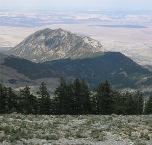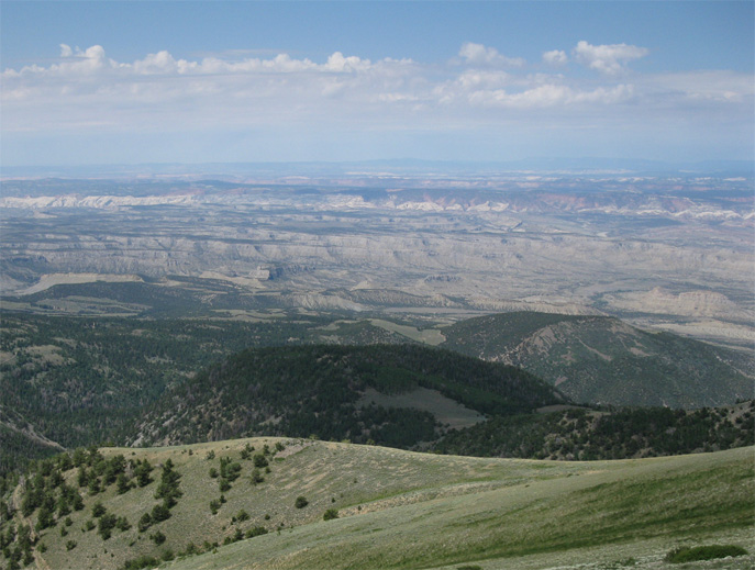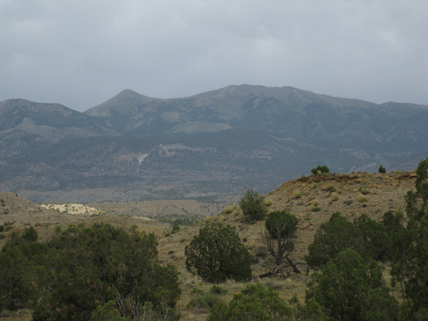
Mt. Ellen viewed from the west. Mt. Ellen "Peak" is on the left but the summit is near the center of the ridge.
When you decide to summit the highest point in a mountain range, you don’t expect it to be easy. Remote locations, long approaches and steep trails are usually assumed if you are going after the “big one” in a range. However, when breaking camp on a June morning and heading towards Mt. Ellen, the 11,522’ high point of the Henry Mountains, I felt pretty confident Lexi and I would easily attain the summit. From what I had researched, the hike to the top would pose few challenges. A rough but drivable road bisects the northern end of the Henrys and passes within 2 miles of the top of Mt. Ellen. From there, the trailhead is only 1,000 vertical feet below the summit. My only concern was weather, which looked pretty dark southwest of Hanksville. While filling up for gas, I circled around the parking lot with my weather radio trying to pick up a forecast. Aside from looking like an idiot, this really accomplished nothing. In the static coming from the radio, I could barely make out the “Speak and Say” voice say, “chance of afternoon thunderstorms”. I could have figured that out without waltzing around the Chevron parking. However, this use of technology occasionally makes me feel better by a) justifying its purchase and b) giving me a slight bit of assurance that my instincts are correct.
There are two approaches to the trailhead at Bull Creek Pass. We drove what looked like the most direct route: from the east. This route still involved a lot of meandering before climbing southwest around the west side of Bull Mountain.
It was here that the Henrys took on a look vastly different than the surrounding desert, even different from what we experienced the day before near the southern part of the range. Juniper and sage thickened the hillsides, pine trees became more prevalent and the dry corridors on the lower elevations were ringed by high, green patches of forest with a few snow banks. Soon we were crossing small streams and driving a two track dirt road through thick forests that reached out towards the Xterra. The skies above us were blue and it looked like we would in fact have a clear weather window to get to the summit. Past a well occupied campground, the road really started to climb as we approached Wickiup Pass. The switchbacks were so steep that the road disappeared behind my hood around the corners. 2 hours and 45 minutes after leaving Goblin Valley, we parked next to a lone SUV at the trailhead and started towards the day’s goal.
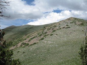
The trail was obvious from where we parked; running north along the ridge and occasionally dropping along the west slope to cut off some “up and down”. The trail was entirely exposed– no shade, but temperatures were very comfortable at the high altitude. About a half mile or more from the trailhead, the trail turns to mostly talus, but it is leveled out well and easy to follow. Reaching 11,000′ without too much work, we started seeing cow pies on some of the flatter saddles of the ridge. Initially I thought it must be some hell of an adventurous cow that would wander all the way up here, but a friend reminded me a few days later that a wild roaming bison heard does call the Henrys home, so those were probably buffalo pies. Unfortunately there were none to be seen on this day, but since I’m not too sure on the temperament of bison, I suppose it was OK we didn’t run into one.
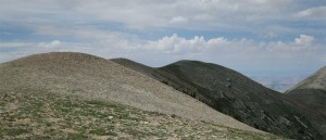
The whole way on our approach, we had difficulty determining the actual summit. While driving up, we observed a sharp peak at the end of the ridge which I assumed was the top of Mt. Ellen. From the elongated text on the map however, I realized that Mt. Ellen isn’t so much a peak as a long mountain, approximately 4 miles in distance, with a northern and southern summit. Where we parked was actually right in the middle of Mt. Ellen and the prominent peak we saw at the northern end was called Mt. Ellen “Peak” on our map. However, there is an unassuming point on the ridge, less than 2 miles from the trailhead, which is actually 16 feet higher than Mt. Ellen Peak.
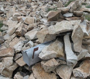
We would have never known we were on the summit had there not been cairns and the mailbox holding the summit register. I felt satisfied that we didn’t need to go on to the peak at the end of the ridge, which would have required an extensive “down and up” climb. This mound, the 2ndto last before the “peak”, was the highpoint.
It hadn’t taken us long to get there, around an hour and fifteen minutes, so we had hardly broken a sweat. Because of the angle that the ridge follows, you really can’t even see the summit from the trailhead; it kind of hides itself between neighboring mounds, which makes the achievement somewhat anti-climactic. Someone had crafted a stone bench with flat rock backrests that looked out over the northern landscape. After verifying our location on the GPS and sending a Spot “OK” message, we sat down and I cracked an Odell’s 90 Shilling Ale.
90 Shilling is a Scottish style amber that is one of the original brews of Fort Collin’s Odell Brewery. Sometimes I feel English/Scottish ales need to be “flat” for lack of a better term, to be authentic. However, this beer seems to balance carbonation with a traditional ale body. This makes for a fast, pleasant flavor with a subtle and pleasant lingering aftertaste. That is the quality I like of this beer, a character that doesn’t overpower with each successive sip. I get hints of lemon in the crisp taste, which refreshes while still retaining an earthy flavor. Odell shares a home with the much more widely distributed New Belgium, however, there is a great dichotomy between these two Fort Collins breweries. While New Belgium specializes in Belgian style beers, Odell has instead chosen to focus on English style beers and I think it’s a great primer on beer to compare both Fat Tire and 90 Shilling and explore the differences in these ambers. Regardless of where your allegiance lies, I would strongly recommend giving this beer a try… if you can find it on your journeys abroad.
It was probably the most comfortable either of us had been on a summit and Lexi said it was a “visit to a day spa” compared to Cass Creek Peak the day before. I viewed the western side of the mountain below us. Sprawling green hillsides with rubbed off khaki patches of dried grass and big open green meadows separated us from Capitol Reef’s Water Pocket Fold. An overcast day to the north made it tough to see much definition in the distance, but I think I was able to see Nebo, the highpoint of the Wasatch to the northeast and obviously the LaSal and Abajo ranges to the east.
Most stunning though may have been the transition from our mountain top perch to the abrupt rock formations of Capitol Reef. I had never actually visited Capitol Reef National Park, but I now had the privilege of seeing it from above, both from the west and now the east. In a state full of geographical contrasts, this had to be the starkest example of ancient geological forces handiwork.
Judging from the well-worn trail and ease of access, I shouldn’t have been too surprised at how full the summit register was. In fact, I found them in two different locations on the top. They were almost full and made up of tattered notebooks, torn loose-leaf and some more official looking journals, including an official USGS notebook. I made an entry on a piece of my notebook paper and put it in the mailbox, but when you are one of hundreds on a motley collection of names stuffed haphazardly in various places, the selective satisfaction of entering your name on a neat, organized summit register is lost.
We chose to leave the trailhead by driving down the opposite side of the mountain, towards the west. This is a longer drive mileage wise as it really meanders around the valley below, but overall, I think this road was in better condition than our approach from the east. However, neither of the approaches should be taken lightly. As we saw during our exit when a short cloudburst soaked the roads, it wouldn’t take much to make them impassable.

