Mt. Ellen and Odell’s 90 Shilling Ale: A Visit to the Day Spa

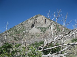
Mt. Ellen viewed from the west. Mt. Ellen "Peak" is on the left but the summit is near the center of the ridge.

When you decide to summit the highest point in a mountain range, you don’t expect it to be easy.  Remote locations, long approaches and steep trails are usually assumed if you are going after the “big one” in a range.  However, when breaking camp on a June morning and heading towards Mt. Ellen, the 11,522’ high point of the Henry Mountains, I felt pretty confident Lexi and I would easily attain the summit.  From what I had researched, the hike to the top would pose few challenges.  A rough but drivable road bisects the northern end of the Henrys and passes within 2 miles of the top of Mt. Ellen.  From there, the trailhead is only 1,000 vertical feet below the summit.  My only concern was weather, which looked pretty dark southwest of Hanksville.  While filling up for gas, I circled around the parking lot with my weather radio trying to pick up a forecast.  Aside from looking like an idiot, this really accomplished nothing.  In the static coming from the radio, I could barely make out the “Speak and Say” voice say, “chance of afternoon thunderstorms”.  I could have figured that out without waltzing around the Chevron parking.  However, this use of technology occasionally makes me feel better by a) justifying its purchase and b) giving me a slight bit of assurance that my instincts are correct.

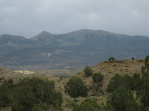
There are two approaches to the trailhead at Bull Creek Pass.  We drove what looked like the most direct route: from the east.  This route still involved a lot of meandering before climbing southwest around the west side of Bull Mountain.

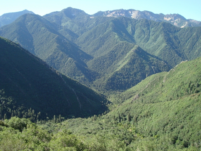
The drive from the east follows the Bull Creek drainage, pictured here. The peak is Bull Mountain.

It was here that the Henrys took on a look vastly different than the surrounding desert, even different from what we experienced the day before near the southern part of the range.  Juniper and sage thickened the hillsides, pine trees became more prevalent and the dry corridors on the lower elevations were ringed by high, green patches of forest with a few snow banks.  Soon we were crossing small streams and driving a two track dirt road through thick forests that reached out towards the Xterra.  The skies above us were blue and it looked like we would in fact have a clear weather window to get to the summit.  Past a well occupied campground, the road really started to climb as we approached Wickiup Pass.  The switchbacks were so steep that the road disappeared behind my hood around the corners.  2 hours and 45 minutes after leaving Goblin Valley, we parked next to a lone SUV at the trailhead and started towards the day’s goal.

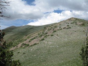
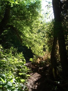
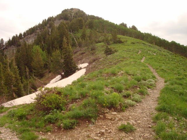
This is what the trail looks like leaving the trailhead.

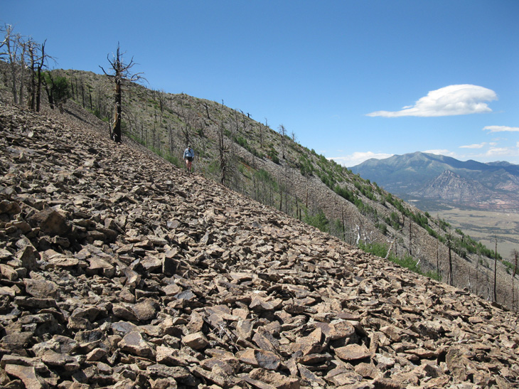
The trail was obvious from where we parked; running north along the ridge and occasionally dropping along the west slope to cut off some “up and down”.  The trail was entirely exposed– no shade, but temperatures were very comfortable at the high altitude.  About a half mile or more from the trailhead, the trail turns to mostly talus, but it is leveled out well and easy to follow.  Reaching 11,000′ without too much work, we started seeing cow pies on some of the flatter saddles of the ridge.  Initially I thought it must be some hell of an adventurous cow that would wander all the way up here, but a friend reminded me a few days later that a wild roaming bison heard does call the Henrys home, so those were probably buffalo pies.  Unfortunately there were none to be seen on this day, but since I’m not too sure on the temperament of bison, I suppose it was OK we didn’t run into one.

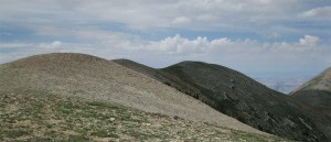
The mound just barely visible left of center is actually the top of the Henry Mountains.

The whole way on our approach, we had difficulty determining the actual summit.  While driving up, we observed a sharp peak at the end of the ridge which I assumed was the top of Mt. Ellen.  From the elongated text on the map however, I realized that Mt. Ellen isn’t so much a peak as a long mountain, approximately 4 miles in distance, with a northern and southern summit.  Where we parked was actually right in the middle of Mt. Ellen and the prominent peak we saw at the northern end was called Mt. Ellen “Peak” on our map.  However, there is an unassuming point on the ridge, less than 2 miles from the trailhead, which is actually 16 feet higher than Mt. Ellen Peak.

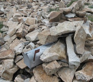
This was a strong indicator that we had reached the top.

We would have never known we were on the summit had there not been cairns and the mailbox holding the summit register.  I felt satisfied that we didn’t need to go on to the peak at the end of the ridge, which would have required an extensive “down and up” climb.  This mound, the 2ndto last before the “peak”, was the highpoint.

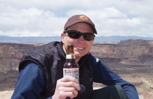
It hadn’t taken us long to get there, around an hour and fifteen minutes, so we had hardly broken a sweat.  Because of the angle that the ridge follows, you really can’t even see the summit from the trailhead; it kind of hides itself between neighboring mounds, which makes the achievement somewhat anti-climactic.  Someone had crafted a stone bench with flat rock backrests that looked out over the northern landscape.  After verifying our location on the GPS and sending a Spot “OK” message, we sat down and I cracked an Odell’s 90 Shilling Ale.

Odell's flagship beer, 90 Schilling Ale

90 Shilling is a Scottish style amber that is one of the original brews of Fort Collin’s Odell Brewery.  Sometimes I feel English/Scottish ales need to be “flat” for lack of a better term, to be authentic.  However, this beer seems to balance carbonation with a traditional ale body.  This makes for a fast, pleasant flavor with a subtle and pleasant lingering aftertaste.  That is the quality I like of this beer, a character that doesn’t overpower with each successive sip.  I get hints of lemon in the crisp taste, which refreshes while still retaining an earthy flavor.  Odell shares a home with the much more widely distributed New Belgium, however, there is a great dichotomy between these two Fort Collins breweries.  While New Belgium specializes in Belgian style beers, Odell has instead chosen to focus on English style beers and I think it’s a great primer on beer to compare both Fat Tire and 90 Shilling and explore the differences in these ambers.  Regardless of where your allegiance lies, I would strongly recommend giving this beer a try… if you can find it on your journeys abroad.

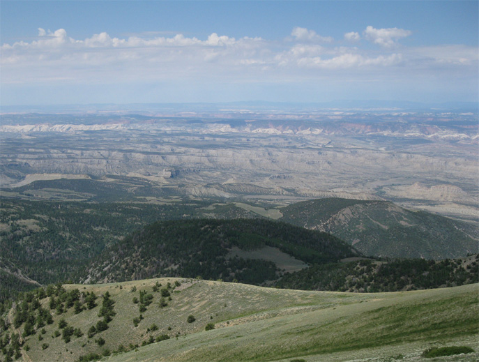
It was probably the most comfortable either of us had been on a summit and Lexi said it was a “visit to a day spa” compared to Cass Creek Peak the day before.  I viewed the western side of the mountain below us.  Sprawling green hillsides with rubbed off khaki patches of dried grass and big open green meadows separated us from Capitol Reef’s Water Pocket Fold.  An overcast day to the north made it tough to see much definition in the distance, but I think I was able to see Nebo, the highpoint of the Wasatch to the northeast and obviously the LaSal and Abajo ranges to the east.

The Henry Mountains give a great vantage point for Capitol Reef.

Most stunning though may have been the transition from our mountain top perch to the abrupt rock formations of Capitol Reef.  I had never actually visited Capitol Reef National Park, but I now had the privilege of seeing it from above, both from the west and now the east.  In a state full of geographical contrasts, this had to be the starkest example of ancient geological forces handiwork.

Judging from the well-worn trail and ease of access, I shouldn’t have been too surprised at how full the summit register was.  In fact, I found them in two different locations on the top.  They were almost full and made up of tattered notebooks, torn loose-leaf and some more official looking journals, including an official USGS notebook.  I made an entry on a piece of my notebook paper and put it in the mailbox, but when you are one of hundreds on a motley collection of names stuffed haphazardly in various places, the selective satisfaction of entering your name on a neat, organized summit register is lost.

We chose to leave the trailhead by driving down the opposite side of the mountain, towards the west.  This is a longer drive mileage wise as it really meanders around the valley below, but overall, I think this road was in better condition than our approach from the east.  However, neither of the approaches should be taken lightly.  As we saw during our exit when a short cloudburst soaked the roads, it wouldn’t take much to make them impassable.

Posted in Colorado Brews, Utah Summits | Tagged , , , , , | Leave a comment

Grandeur Peak paired with MacTarnahan’s Summer Grifter IPA

Of all the mountains that line up like chess pieces along the east side of the Salt Lake Valley, Grandeur Peak is likely the most popular for urban hikers looking for a quick summit to stand on. Plus, it’s an awesome mountain for a Summit Brew, like with a bottle of MacTarnahan’s Summer Grifter IPA.

MacTarnahan's Summer Grifter on Grandeur Peak

Grandeur Peak

Mountaineers stomp straight up Grandeur’s steep west face as training for bigger climbs, but the rest of us lesser humans mosey along the easier trail that ascends to the peak from Church Fork in Mill Creek Canyon. For Summit Brew purposes, the easy way is the beer way. So with my beer stowed safely in my pack and the dog, Lucy, at my side, I headed up the Grandeur Peak Trail on a hot August day.

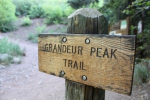
A sign at the trail head marks the way to the summit of Grandeur Peak.

The path to the summit is always crowded. Visibility of the mountains from the valley is high, since Grandeur towers over I-80 as it snakes into Parley’s Canyon. The fact that it’s seen from most everyone’s back yard in the north end of the valley means it’s a peak almost everyone attempt to climb at some point, and on this day, it seemed everyone was there at once, despite the oppressive heat.

At first, the hike was pleasant as the trail winds through the forest along the bottom of Church Fork. A small creek runs down the center and several crossings give the dog ample time to splash, play and take a drink. In fact, the water source and open spaces make the Grandeur Peak Trail one of my favorite hikes for the dog. She flat-out loves it. Eventually though, the trail rises above the forest floor and into unshaded, steep switchbacks that lead to the ridge between Parley’s Canyon and Mill Creek. It was here that the heat hammered down, the dog started to lag, and a few boy scout troops led by sorely out-of-shape scout leaders struggled to make their way up.

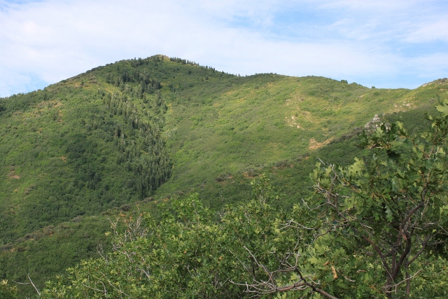
View of Grandeur Peak's backside in Church Fork. What looks like the top is actually a false summit.

I’ve flat-out ran up this trail before, but the temperature was so high that anything faster than a brisk shuffle invited heat stroke. The beer getting warmer in my pack was my only motivation, and the sweating bottle taunted me into continuing. Poor Lucy was so hot that no amount of water from my Camelbak slaked her thirst, and she frequently stopped under small patches of shade, refusing to go on (but eventually relenting to chase after me.)

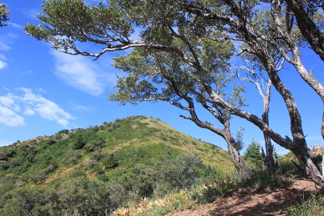
Almost there. Grandeur Peak's summit from the ridge.

Finally the trail leveled out at the saddle where it splits. The well-traveled left fork goes directly to the summit of Grandeur Peak. From here, the boot-tamped dirt gave way to rockier terrain with a few scrambling sections. Although the hike is easier than most peaks on the Wasatch Front, there are still areas where caution is mandatory. Only 1/2 mile along the ridge led me to the summit, where, amazingly and despite the crowds, I had the top all to myself. What luck! It seems Ullr was smiling down on me so I could enjoy a beer in peace with nothing but a sweeping view of the Salt Lake Valley below my feet and a slight breeze to cool me off under a blazing summer sun. It was time to break out the suds.

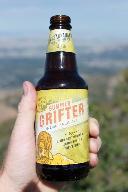
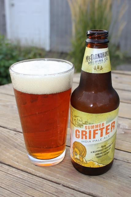
MacTarnahan’s Summer Grifter IPA

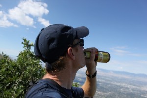
Toasting the Salt Lake Valley below with a MacTarnahan's Summer Grifter IPA.

On such a hot day, I wouldn’t usually pack an IPA. Generally, a lager or pilsner is far more quaffable than the hopped-up flavor explosion an India Pale Ale brings on. But seeing as how the MacTarnahan’s Summer Grifter IPA has the word “summer” in the name, I figured it must be refreshing after a sweat-soaked hike. Turns out, not so much.

Enjoying a MacTarnahan's Summer Grifter atop Grandeur Peak.

The MacTarnahan’s Summer Grifter is a pretty typical IPA. It’s nicely hopped, has a strong malt base, and has enough alcohol to remind you that you’re drinking a beer. MacTarnahan’s, which is based out of Portland, Oregon, describes the Summer Grifter as, “a limited edition IPA for the summer whose cunning malt taste and hefty hop aroma will steal your attention and disappear in a wink!” It’s true that the hop profile is a bit different somehow, but overall I’d say the flavor is typical of the style.

Drinking the Summer Grifter starts out smooth, with a citrus-infused nose that you’d expect. While there’s not a whole lot of up-front hop smells coming off the head, it all punches you when swallowed. There’s even a hint of caramel, making it a sort of cross between an amber and IPA. In the glass, the color is a bit unusual for an IPA, with surprising amber, malty hues. The beer has an impressive, meaty head right after being poured, with tons of lacing on the inside of the glass. I’d say it’s a hearty IPA – a bit strange for a summer seasonal. While not the best IPA I’ve ever had, it’s still very good. The Summer Grifter is probably best consumed on cool summer evenings and not under the heat of the mid-day sun.

MacTarnahan's Summer Grifter in the pint glass.

MacTarnahan’s Summer Grifter has a 54 IBU and is 6.2% ABV. For more information, visit www.macsbeer.com

Posted in Oregon Brews, Utah Summits | Tagged , , , , , , , | Leave a comment

Church Fork Peak paired with Boulder Beer Hazed & Infused

Church Fork Peak as seen from the saddle on the Mill Creek Canyon ridge.
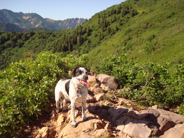
An unloved peak meets a much-loved beer. Along the ridge that separates Parley’s and Mill Creek Canyons, Church Fork Peak is the outcast, a mountain hidden beneath the shadow of the ever-popular Grandeur Peak to the west, or the impressive summit of Mount Aire to the east. But I was in the mood to take the road less traveled, so with a bottle of Boulder Beer Hazed & Infused in my pack, I set out to climb Church Fork Peak with my dog, Lucy.
Church Fork Trail is thick with foliage.

Church Fork Peak is not a summit to scoff at. Rising to 8,306 feet, it’s comparable to other mountains in the northern part of the central Wasatch.  The way to get there is the same as a hike to Grandeur, which I have done dozens of times. Lucy and I drove up Mill Creek Canyon and parked at the Church Fork trailhead. As usual, after unleashing the dog, she immediately bounded up the trail like a canine gone mad, drunk on the smells and freedom of the woods. I appreciated her enthusiasm, and gave chase; running after her in a split decision to run my hike. We both bounded over rocks and roots, streams and bridges. Thankfully, many parts of the trail are too steep or rocky (sometimes both) to run on, so we hiked at normal speed until the trail leveled out again for another bit of mountain jogging.

At first the Church Fork Trail goes directly up the drainage of the same name until it begins to switchback and traverse the north face of Church Fork Peak. Switchbacks are the main event here as the path steeply ascends above the pine forest below, giving way to scrub oak and bushes. Finally, the trail leads to a saddle overlooking Parleys Canyon.

Looking down Church Fork into Mill Creek Canyon from the north face of the peak.

It is here at the saddle that the masses turn left to continue the 1/2 mile to the summit of Grandeur Peak. But a right turn leads one to solitude at the top of Church Fork Peak. Lucy and I chose the faint trail that snaked east through rock gardens and shin-scratching foliage. The path to the summit is nothing more than a deer trail that disappears and reappears at random. An obvious way to the top can lead to bushwhacking through oak trees, while no trail at all allowed an easy way to the top. No matter how we tried to get there, it was impossible to get lost – the summit of Church Fork Peak was right in front of us the entire time… all we had to do was hike to it.

Lucy near the summit of Church Fork Peak.

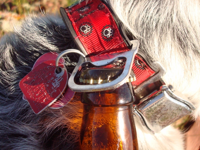
At the top, there was no USGS marker, only a lonely rock cairn to mark the summit of Church Fork Peak. Cactus growing between cracked rock composed the top of the mountain, with nowhere to sit and enjoy the view without risking a butt-cheek full of needles. But the view was tremendous, almost as good as the vistas offered by neighboring peaks. So after watering the dog and eating a snack, I pulled out my reward: a Boulder Beer Hazed & Infused. But wait! I forgot a bottle opener! Disaster and a melancholy hike back down sans suds was my sad future until I remembered something. Lucy’s collar has a bottle opener on it! The dog saved the day and opened my beer for me. Good girl!

Lucy saved the day with her Super Collar, complete with bottle opener. Good dog.

Boulder Beer Hazed & Infused

Boulder Beer Hazed & Infused atop Church Fork Peak with Salt Lake City far below.

Hazed & Infused is a brew from the Looking Glass series of specialty beers from Boulder Beer in Colorado. It’s an American-style Pale Ale that the brewery says is an, “unfiltered dry-hopped ale is “hazed” in its natural state and “infused” with Crystal and Centennial hops.” Excited to taste it, I wrapped my lips around it and took a swig.

Taking a swig of Hazed & Infused

Typical citrus smells and tastes one would expect describes the beer, and it’s not overly complex. Such a simple beer means it’s easy to drink and doesn’t require much investigation to discover the flavors. A definite malty, caramel dance is going on in the bottle with a nice, full-bodied mouthfeel. Hazed & Infused finishes with a nice aftertaste that isn’t very bitter at all. Hops hit up front and blend with the malt and bitter caramel flavors that bubble up to the surface on the back-end. However, Hazed & Infused isn’t as hoppy as I would have liked, especially considering it’s a dry-hopped beer.

In the glass, Hazed & Infused pours with ample head. It’s surprisingly cloudy for a pale ale (hence the Hazed) which comes from it being unfiltered. There’s tons of lacing on the sides of the pint glass, and the color is a light amber, even orange swinging to the gold side of the spectrum. Noticeable hoppy aroma wafts off the head due to the dry hopping of Crystal and Centennial hops. But again, I hoped for more complex hop flavor, especially up front.

Boulder Beer Hazed & Infused is 4.8% alcohol, and is available in liquor stores in various markets across the country. To find it in your area, visit BoulderBeer.com

Posted in Colorado Brews, Utah Summits | Tagged , , , , | Leave a comment

Cass Creek Peak/ Pyramid Curveball Blonde

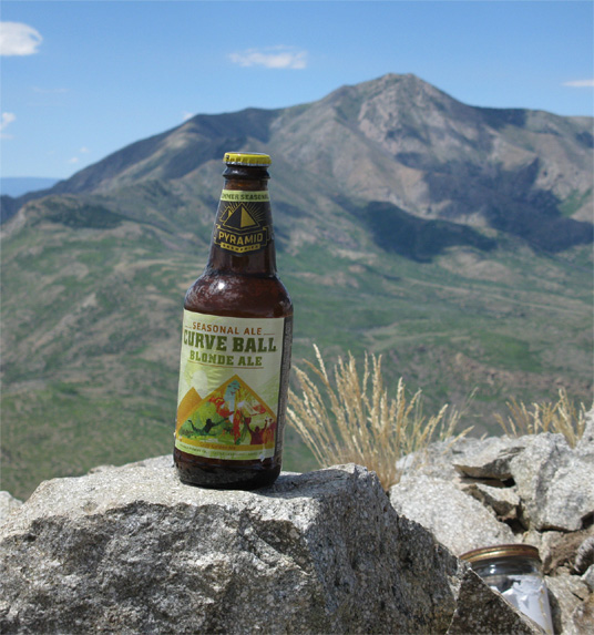
Curveball Blonde with Mt. Pennell in the background

Unless you are jumping into Lake Powell, July is normally not the time to take a weekend trip to southern Utah.  However, with the calendar reading July 16th, there I was driving among the dunes and dry washes of Garfield County.  We were getting closer to Bullfrog, a ferry crossing on Lake Powell, and after miles and miles of dry redrock, I felt a slight urge to keep on driving to the marina and  take a dip in the Colorado.  However, this website isn’t beachBrew.com and I wasn’t a college kid with a cooler of PBR, I was in this remote part of Utah with my girlfriend for a SummitBrew expedition to the Henry Mountains.

The Henry Mountains, isolated by the deep canyons of the Colorado River and vast expanses of desert, are a little known and seldom visited mountain range.  They were one of the last mountain ranges in the continental U.S. to be mapped and were initially identified by the John Wesley Powell expedition of 1869.

The Henry Mountains in Southern Utah


On this day, we were heading to the southern end of the range.  Turning off the state highway, we began 14 rough miles driving around the southern end of Mt. Hillers, then north towards Stanton Pass.  We didn’t come across another soul while slowly progressing towards the trailhead at 7,300′.

Our trail would be a very old and faint 4WD road that runs east from the road, along the normally dry Cass Creek to a saddle between Mt. Hillers and Cass Creek Peak.  This road does appear on some maps but without the coordinates in my GPS, I wouldn’t have been sure we were starting in the right place.  We parked in an area that looked like a pulloff on the right side of the road where a burnt stand of trees bordered an overgrown meadow.  There was a Carsonite marker nearby, but I saw nothing on that marker indicating a “trailhead” of any sort.  From what I had read on summitPost.org I didn’t expect any obvious clues, although I did expect some evidence of ATV use, but there wasn’t even that.  The 4WD road looked like it hadn’t been driven in years.

View of Cass Creek Peak from the trailhead

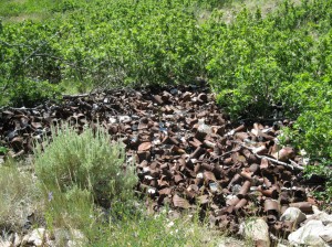
We hiked east through the meadow where our socks collected every burr an thistle 6″ above ground until we lost the “road” in the thick brush.  I decided the best option would be to hike up the deep, cluttered bed of Cass Creek since it seemed like the most direct route to the saddle.  [On our return hike, with the trail slightly easier to follow, we found the 4WD road does go the whole way up.  It sort of jogs to the south of the meadow before narrowing between talus on the left and scrub oak on the right.  The road hugs the slopes right of the thick scrub oak.]  As the creek bed became steeper and harder to climb, I imagined the rushing torrents of snowmelt furrowing this gash just 3 or 4 months ago, leaving all these jammed, crooked tree hurdles tossed about like scattered kindling.  I could tell from the impassibility and atmosphere of our surroundings that few people choose to come here.  A dumping ground of old, rusty steel cans hinted that mining or ranching brought people here at one time, but judging from the pull tabs on the beer cans, it had been quite some time.

The artifacts of a distant time in the Henry Mountains

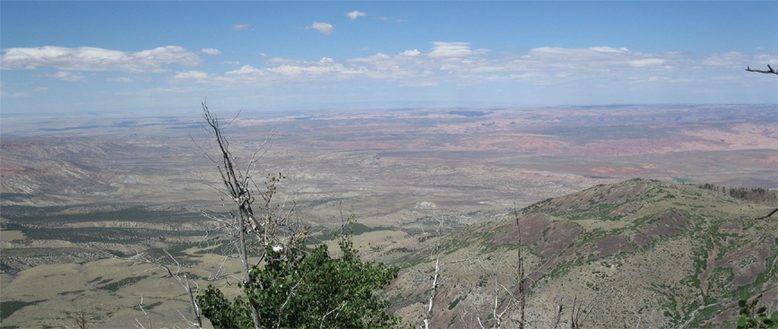
After 1,000′ of climbing and passing through a stand of aspens, we reached the saddle at about 8,500′.  We could now look to the east and see the expanse of the Colorado Plateau.

Looking east from the side of Cass Creek Peak

In the distance were the LaSal and Abajo mountain ranges and in between, patches of crusty shades of brown, gray, dark green and red that recessed across in scattered levels; a flat landscape that never transitioned in a smooth manner until the dark green slopes of these mountains.  The saddle had a hat-losing gale of wind that funneled at us from the south and whipped through the narrow and bare slopes on either side of us.  We took shelter behind a downed ponderosa and ate a lunch which was had too light a ration of string cheese for Lexi’s liking.  “I was trying to save weight,” I said, immediately realizing how stupid that sounded when I was bringing a bottle of beer to the top.

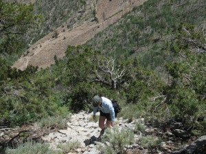
After a brief rest, we started north, up a steep but short scree slope that led to Cass Creek Peak.  While it only stood at 9,400′, given the rough going we had experienced just to get this far, I didn’t question its worthiness for a summit brew.

Lexi climbing up the slope of Cass Creek Peak

We climbed the slope above the saddle for about 300 vertical feet and reached the ridge that ran west to the peak, staying mainly on the north side.  Less than an hour after we left the saddle, we reached a cluster of small summits.  I found a jar with a notebook on furthest mound which was the summit.  The small notepad in the jar looked brand new, with no tattered pages and some slight fading on the cover.  When I opened it to a random page near the top, it was empty, and it took until about 4 or 5 pages from the top for me to find an entry.  The very first chronological entry was from a Coloradan who put the jar there in 2008.  The next page had a rather boastful and foul mouthed entry from a year later.  I’m not sure if it was tongue in cheek or not, but this couple was pretty proud of themselves for reaching the top, and used the “big-daddy” (or more fittingly, “big mother”) or curse words to describe the peak.  Still, I applaud them for taking the time to come to such a remote place.  The final entry was in May of this year.  I’m sure not every climber has made an entry, but it seemed safe to say that this peak has averaged about one visit per year since 2008.  Hell, this year, two groups had done it within 60 days of each other and I laughed as I thought of Cass Creek Peak having a busy year.

We spent about an hour on the top, Lexi drinking her Diet Coke and I drank a Pyramid Brewing Curveball Blonde Ale.  Judging by the shards of brown glass we saw in the rocks, it wasn’t the first summit brew on Cass Creek but it would have been nice for them to pack out rather than christening the peak like some ship on a maiden voyage.  If you can pack it in, you can pack it out.  I was suspicious that it was the work of the overly proud couple from register.

I liked Curveball.  It doesn’t have much of a bouquet or head but it was effervescently carbonated and the sharp, clean taste refreshed me as I looked northeast towards some of the bigger giants of the Henry Mountains like Mt. Pennell and Mt. Ellen.

Up on the ridge of Cass Creek Peak with Mt. Ellen in the distance

The initial taste was clean, but I couldn’t really pick up any subtle flavors or after taste… maybe a little banana and light citrus.  Overall, I found it refreshing and without excessive character.  It is a lagered beer, so often times that takes some of the dimension out of a beer’s flavor, yet I’ll be the first to admit, I like lagers, mainly for their drinkability.  The simplicity of a lager is what your craving, especially in the summer.  This blonde ale had a golden, semi-clear color with just enough body without overloading you.  Still, I would have liked just a bit more of a unique flavor to give it a little more distinction.  Maybe it was fitting for Cass Creek Peak, a small but rewarding peak that doesn’t have the stature of some of its neighbors, but is still rewarding none the less.

Posted in Utah Summits, Washington Brews | Tagged , , , | Leave a comment

Gobblers Knob paired with Squatters Big Cottonwood Amber

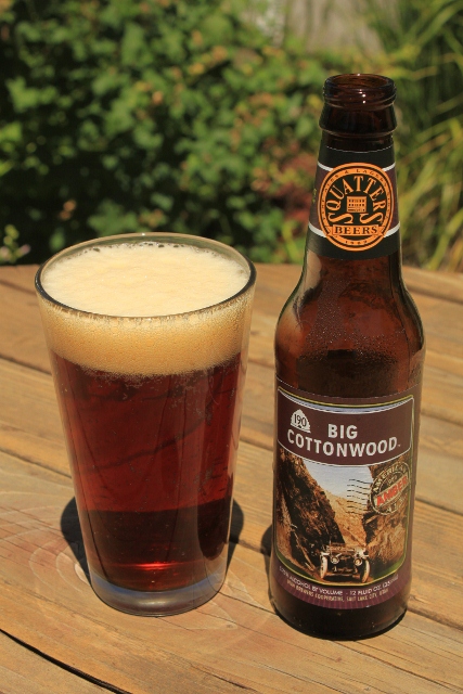
Gobblers Knob is either the most awesome, or most funny named peak in the Central Wasatch range. But despite its strange moniker, the peak is among the most prominent mountains that lord over the canyons of Big Cottonwood and Millcreek. “The Knob,” as we locals are fond of calling it, is a popular destination peak to “bag” for summer hikes. Multiple trailheads in two canyons will get you there, with varying degrees of difficulty from the easy Butler Fork ascent, to the brutally steep stairmaster in Alexander Basin. The top of Gobblers Knob is also a magnificent place to enjoy a summit brew, like the new Big Cottonwood Amber Ale from Squatters.

The view of Gobblers Knob from Baker Pass. The summit in the photo is the notorious false summit. The true summit cannot be seen during the entire hike. Not a shabby place to enjoy the new Squatters Big Cottonwood Amber Ale.

Although I’ve made several ascents of Gobblers Knob from every possible trail, on this day I chose the more mild Butler Fork approach. I wanted to run my hike, so the near-vertical faces in Alexander Basin were certainly out of the question. The Butler Fork trailhead is located eight miles up Big Cottonwood Canyon, and begins at a dirt pullout on the north side of the road. The trail is marked by a large sign. As I ran, the path meadered along a stream and crossed a wood bridge. From here, the hike immediately got steep as it rose above the creek on the side of the drainage. Too steep to run. At the top, the trail leveled out for a long time as it crossed another footbridge which marked the entry to the Mount Olympus Wilderness Area.

Wildflowers bloom on the ridge line above Mill A Basin.

From this point, the hike got really pretty, really fast. Huge aspen trees extended into the Utah sky, surrounded by a blanket of wildflowers and bushes. The trail forked left toward Mill A Basin where it soon switchbacked several times (again the running ceased) until it topped out on a ridge of Circle All Peak. An impressive view of Mill A Basin and Mount Raymond deserved a pause in the action for some photos and to smell the multitudes of wildflowers.

After a short break, I continued toward my goal by following the trail as it traversed the south flank of Gobblers Knob through more aspen forests. Another fork appears here, with the left turn taking hikers to the summit of Mount Raymond (a peak for a future summit brew for sure.) But with Gobblers the destination, and a Big Cottonwood Amber warming up in my pack, I made haste to finish the hike.

Steep and rocky is the name of the game on the ridge that gets hikers to the top of Gobblers Knob, and I hammered my thighs up the grade. This part of the hike was aggravating, as several false summits tricked me into thinking the end is near, only to discover there is more to go. (of course I already knew this, but it’s fun to pretend you’re climbing a peak for the first time and hopefully see things with fresh eyes.) Eventually, the real summit of Gobblers Knob came into view and a short traverse on the ridge got me to the point where it was impossible to climb any further – the summit.

View of the Big Cottonwood Canyon mountains from the summit of Gobblers Knob.

At the top, I found a rock seat, cracked open my Squatters Big Cottonwood Amber Ale, and took in one of the most amazing 360-degree views in the tri-canyon area.

Squatters Big Cottonwood Amber Ale

Squatters Big Cottonwood Amber Ale. The USGS marker makes a good coaster.

The Big Cottonwood Amber Ale is the latest concoction from the mind of Squatters Brewmaster Jenny Talley. It’s described on the label as, “inspired by one of Utah’s most magnificent canyons… a robust, deliciously balanced, Cascade dry-hopped amber ale with floral citrus aromas [and] layers of malted barley flavors.”

I have to admit, I was excited to try this new take on the classic American-style amber ale, and it sure didn’t disappoint, especially when enjoyed on a mountain top.  Up front, the brew tastes like a typical amber full of malty goodness, but it’s remarkably balanced with the malt flavor. But what really sets this amber ale apart from the crowd (and is my reason for peeing a little when I took my first swig) is the bang at the end. The Big Cottonwood is very hoppy for an amber, yet somehow the hops don’t overpower the malts. Rather, the hop profile gives the beer a citrus nose that stands out even more when it warms up a bit. Overall, it has a fun mouthfeel with hops dancing around on the tongue.

Squatters Big Cottonwood Amber Ale in a glass.

In a glass, the Big Cottonwood Amber Ale pours with an average head that disappears quickly. Some lacing sticks inside the glass while it’s ravenously consumed. The beer has surprising clarity for an amber ale, especially considering the amount of malt and hops that goes into it. The color is a deep red, the true definition of amber. When holding it up to the light, I could imagine a jurrassic-era mosquito encased for eons within an amber shell of the same color.

The Squatters Big Cottonwood Amber Ale is now one of my new favorite amber ales, and it will most defenitely find a happy home in my fridge.

Available in Utah State Liquor Stores, the Utah Beer Store, and at the Squatters Brew Pubs in Salt Lake City and Park City. 5.75% alcohol by volume. For more information, visit www.squatters.com

Posted in Utah Brews, Utah Summits | Tagged , , , , , | 4 Comments

Flagstaff Mountain paired with Wasatch Summerbrau Lager

Flagstaff Mountain is one of many peaks that line the snowy ridge south of Alta, creating a mountain wall that looms above town. Taken on the whole, Flagstaff is a shorty next to her big sisters like Mount Superior, but is still a very popular summit for hikers and backcountry skiers alike.

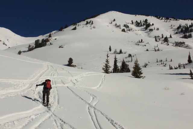
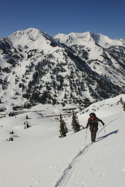
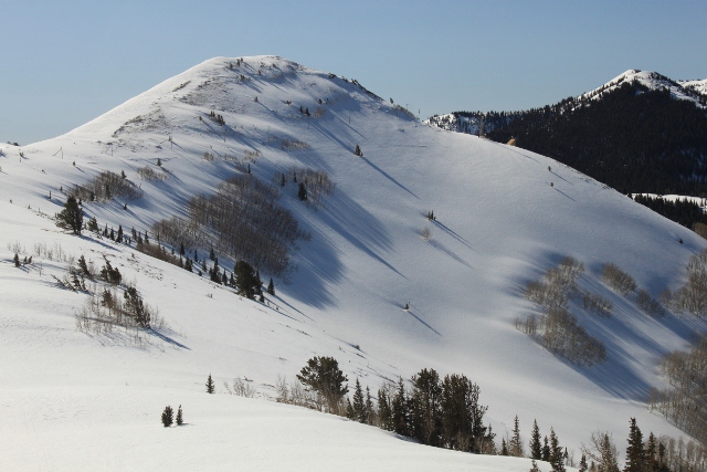
Ski touring to the summit of Flagstaff Mountain from Alta.

In fact, it’s certain that Flagstaff sees the most traffic when she’s covered in snow thanks to the numerous backcountry ski tour routes that can be linked from the top. So when Brewddah and I climbed her flanks for a Summit Brew in early June, we brought skis and climbing skins with our beer thanks to an unusually wet and cold spring here in Utah.

Brewddah ascends Flagstaff Mountain.

The trip began in Alta (as any ascent of Flagstaff starts,) from the trailhead by the Town of Alta municipal building. After gearing up, we skinned up the track to the white, alpine meadows below the mountain. The day was warm, finally, and the sun was shining so bright it hurt to see. An amazing amount of snow for the late spring season made the mountains look like January instead of June.

The ascent up Flagstaff followed the typical route toward Cardiff Pass beneath the powerline, then split off to the right where it then went up on the mountain’s shoulder. The climbing became steeper the closer we got to the summit, and the track went from casual climbing to strenuous switchbacks on icy and wind loaded snow. Once on the ridge, an easy walk to the west brought us to the edge of Reed and Benson Ridge and the 10,530 foot summit of Flagstaff Mountain.

At the top, we were greeted by a view we both know all too well. Alta and Snowbird sat far below to the south, Catherine Pass beckoned to the east, the white peaks along Big Cottonwood Canyon called to us from the north, and Mother Superior held court in the west as the Salt Lake Valley shimmered behind her.

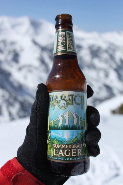
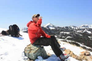
Although it was springtime and sunny, a cold wind blew on the summit, scouring the snow that whipped around us before twirling into the canyons beneath our boots. With winter still in effect and summer only three weeks away, we felt it was appropriate to break out the polar opposite of a winter beer – a seasonal summer lager. In defiance of all the snow, but with great humility and thanks shown to Ullr for the incredible ski season he bestowed upon us, we cracked open a Wasatch Summerbrau Lager. After knocking back a few gulps, we gave Ullr his share by ritualistically pouring some on the mountain for him. Hopefully Ullr won’t be angered by our quaffable offering come next winter.

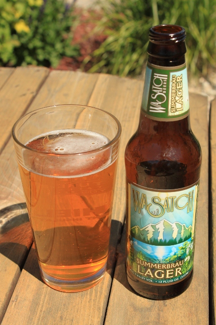
Wasatch Summerbrau Lager

Irony - Wasatch Summerbrau Lager, a summer seasonal, atop a frozen, wind-scoured peak.


Summerbrau Lager from the Wasatch Brewery is a full strength, Czech-style pilsner-lager brewed with German malts and European hops. It comes in at a respectable 5.6% ABV, and according to Wasatch, is a lager, “designed to be the perfect companion for any summer celebration.”

Throwing back a cold Wasatch Summerbrau on a cold Flagstaff summit.

Celebrating on a snow-covered peak counts, right?

On first taste, the Summerbrau Lager is crisp and clean, but doesn’t do much on the front of the tongue. But after swallowing, a somewhat hoppy, flavorful finish makes the palate sing. Also dancing on the tongue is a nice carbonation. Both elements make for a refreshing beer that is hard to stop drinking. And while lagers are a style of beer mostly consumed ice-cold in this country, I found time spent in my pack warmed the beer just enough to unleash all its qualities, rather than hiding behind a numb, frozen tongue.

In fact, I dare say the Wasatch Summerbrau is the most flavorful lager I can remember drinking. I spent a long time trying to decide what it compares to, when it hit me as I stood on the mountain – Summerbrau tastes like a strong Fosters. Does that make Summerbrau, “Utahn for beer?”

Wasatch Summerbrau Lager in a glass.


In the glass, Wasatch Summerbrau pours a see-through, light gold color with very little head. The lack of head is surprising considering how much carbonation is packed into this beer, but the bubbles are also what make it so fun to drink. The taste is pleasant, and classically lager-ish. This beer is hoppy for a lager, but rather than being bitter, has a dry flavor. As a summer seasonal, the Summerbrau is HUGELY refreshing, and is very much a sessionable beer despite the 5.6% ABV.

Plus, there’s a mountain on the label, so that really makes the Wasatch Summerbrau Lager a true “Summit Brew.”

Wasatch Summerbrau is available at the Utah Brewer’s Cooperative Beer Store at 1763 South, 300 West and all Utah Liquor Stores.

Cheers!

Posted in Utah Brews, Utah Summits | Tagged , , , , , , , | Leave a comment

Scott Hill paired with Bohemian Cherny Bock

The Summit: Scott Hill – Big Cottonwood Canyon, Utah

The view of Scott Hill from the Big Cottonwood side, looking across USA Bowl from the west.

Scott Hill. It may sound like a puny mountain compared to other Wasatch Mountain peaks like Mt. Superior or The Pfeifferhorn, but at 10,116 feet, this “hill” is actually an impressive summit. In fact, Scott Hill is the 30th highest peak in Utah, totally worthy of an ascent followed by a tasty brew at the top.

“Puke Hill” is the popular term for this mountain in the summer, as it’s where the Wasatch Crest Trail mountain bike ride begins in earnest with a massively torturous climb. But in the winter, the hill is tamed by snow, and backcountry skiers flock to it on powder days for access to USA Bowl and the Monitors above the Park City canyons.

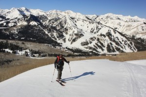
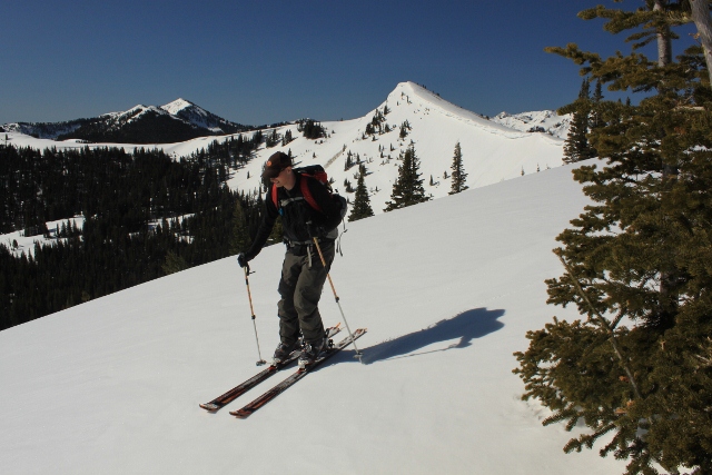
Brewddah skins up the Willows ridgeline to access Scott Hill. Solitude Mountain Resort is in the background.

It was an unusually snowy May when we climbed Scott Hill, and we actually began the day with a plan to bag the summit of Mount Superior with a ski down the famous south face. But avalanche danger caused a road closure by UDOT in Little Cottonwood Canyon, which forced us to instead drive up Big Cottonwood in search of a peak to climb. Seeing as it was late spring and there was still a ton of snow in the mountains, we chose to drive high – all the way to Solitude Mountain Resort across from Scott Hill.

In Solitude’s upper lot, we slapped skins to skis and walked across the highway to a road that winds through a neighborhood of snow-covered cabins. Enough snow had melted on the road to require us walking in our ski boots (despite a constant, glassy sheen of ice) all the way to a skin track that begins below aspen groves at the base of USA Bowl.

It was a relief to leave the pavement and skin on actual snow that was still frozen solid from a lack of spring sunlight. We figured a south-facing slope would have already gotten a lot of sun in the morning, but either the Earth tilted on its axis while we slept, or our internal seasonal sun-clock was off kilter thanks to the warming season. Either way, we were greeted by ice and crust, while sun-filled north slopes taunted us across the canyon.

For over an hour, we skinned through the aspens to the top of the Park City ridgeline above USA Bowl. Scott Hill loomed to the east, still cold in the shadowed morning. Seeking soft snow to ski on, we followed the ridge to No Name Bowl above The Canyons ski resort. After a quick de-skinning, we made easy, fast turns down the steep slope on surprisingly excellent corn snow. Spring skiing at it’s finest! But our intended summit still waited.

Brewddah skis some spring corn snow into No Name Bowl. Scott Hill looms behind.

We converted our skis back to uphill mode and made way for our goal by following a ridge south to Radar Love, a collection of cell phone, radio and television towers above USA Bowl. It was here that we ran into a snowmobiler (sans snowmobile) post-holing the ridge to fix a transmitter for a friend. He instilled a sense of foreboding in us with a tale of slide-for-lifes and the loss of his GPS that careened down the rock-hard face of Scott Hill earlier that morning. Undaunted, we bade him farewell and continued to the rocky summit.

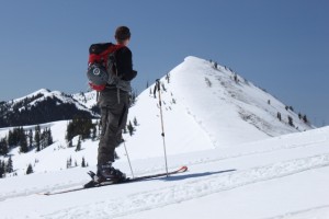
Approaching Scott Hill from Radar Love on the Park City Ridgeline.

Short work was made of the ridge that leads to the top of Scott Hill, although we took great care to avoid a gigantic cornice that formed with recent new snow and wind loading. Once at the top, we were treated to a 360-degree view of the Wasatch Range. We could see Mount Timpanogos to the south and miles of white peaks stretching all the way to Wyoming to the north. With our real-life 3D television surrounding us complete with a brisk wind and silent air, it was time to crack open our reward.

The Brew: Bohemian Brewery Cherny Bock

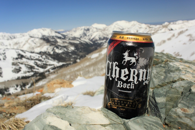
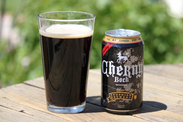
Bohemian Brewery Cherny Bock in all its canned glory atop the summit of Scott Hill.

The Bohemian Brewery in Midvale recently released yet another of their old-world style lager beers in a can. The Cherny Bock Schwarzbier is the third offering from the magic makers at Bohemian to come in a can, and it’s perfect for stocking coolers, or for packing on summit brew trips.

That last point speaks volumes to outdoor lovers, as cans don’t break, they can be crushed when empty (easier to pack out,) and for some unknowable reason (maybe because of ’70s-era Coors commercials,) beer tastes better in a can when you’re lounging by a river, sitting on a mountain top, or hanging out in the parking lot after a satisfying day on the slopes.

Enjoying a cold Bohemian Cherny Bock after the ascent of Scott Hill. A worthy Summit Brew indeed!

It’s notable that Bohemian Brewery’s Cherny Bock is in a can because it’s a dark beer. In fact, Cherny means “black” in Czech. But when you think of canned beer, thin yellow beer comes to mind. Even though Cherny Bock is dark in color, it’s lager properties still make it a very drinkable, refreshing beer. And as a dark beer, the Cherny Bock retains it’s darker flavors which are always welcome in colder climates. I felt it paired very well with the chilly, windy summit on Scott Hill.

Surprisingly, Cherny Bock even tastes great straight from the can, especially when enjoyed outdoors. But like all fine microbrews, the best way to enhance all of the complex flavors is to pour it into a glass. If you do, you’ll notice that it pours very dark, almost black. A nice, thick head holds notes of roasted malt with just a touch of hoppiness. The Cherny Bock is a well-balanced beer that is easy to drink and left us wanting more. And with an ABV of 4.0%, you felt we could have a few without losing any memory of the outdoor adventure we just enjoyed. But we still had to descend on skis over a supportable ice crust, so one beer was enough.

Bohemian Cherny Bock in a pint glass.

Bohemian Brewery Cherny Bock is available in grocery and convenience stores, but if you can’t find it, you can always buy flats of it at the brewery, located at 94 East 7200 South in Midvale, Utah.

For more information and a list of locations where Bohemian is sold, visit the Bohemian Brewery online.

Posted in Utah Brews, Utah Summits | Tagged , , , , | Leave a comment

Pinnacle #1 / North Coast Pranqster

The San Rafael Swell, gouged by canyons and checkered with sandstone towers and mesas doesn’t present the same majestic summitBrew opportunities as the nearby LaSal or Henry mountain ranges, but with most Utah peaks still saturated in white, a 7,000 foot tower less than 3 hours driving from Salt Lake earned the distinction of being my first summitBrew post. At exactly 7,010 feet, Pinnacle #1 slots in near the bottom on my collection of peaks, however, the journey to the top of this crumbling, Parthenon like ruin south of the San Rafael River is an instance where the often ambiguous and quantifiable definitions of a “mountain top” submit to a more qualitative and subjective definition.

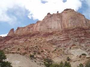
As my girlfriend and I drove south from the San Rafael River campground, the sandstone corridors that surround the river widened and we were driving through a vast, high desert where the friable edges of countless mesas and buttes ran for miles. To the right, a prominent wall of smooth rock sprouted up from a long multi-colored mesa that was littered with boulders and gravel along it’s edge. The wall atop this mesa was Pinnacle #1, and like most Utah towers, it looked impossible to climb without aid. However, the route to the crumbling parapets on top of the Pinnacle runs around the wall and to the opposite side, where a steep, but climbable course is found. The route is well detailed in Steve Allen’s Canyoneering: The San Rafael Swell.

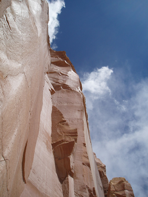
We began our hike by walking about a mile from the road towards the largest debris pile that spills down the side of the mesa. After an easy scramble up the debris pile, we were at the foot of the 600′ face of the Pinnacle. The slick, solid, massive wall was pretty impressive to stare up at, especially with the blue sky above and miniaturized desert below. It stood there stoically, like the remnants of a besieged castle, but after traversing north around the base of the wall, then back south behind it, we saw the perfect construction of the east face was not matched by the west.

While steep, the backside of this monolith had large layers of rounded sandstone, burrowed with numerous erosion holes and sprinkled with large boulders. The round amphitheater continued all the way up to a point just 10 to 15 feet below the top of the wall. From there, the summit was reachable over some boulders below the flat highpoint of the wall.

Allen’s book describes two class 4 sections, which, admittedly, I didn’t know what to make of. I have a general idea of what makes a climb class 4, but I don’t normally climb summits with class 4 sections. Maybe I have climbed peaks with class 4 sections in the past but since this was the first documented occurrence of a class 4 on one of my hikes, I was a little curious.  The first section (right below the start of the amphitheater climb) was a pretty straight forward 10′ section that involved scaling some cracked boulders and grabbing a juniper branch; nothing major. The second section, not far beyond it, created a bit of a delay.  Exposure wasn’t a problem on either of these climbs, but a missed foothold or poor hand hold could have left us injured and quite a ways from help. The two of us evaluated the various Swiss cheese holes and cracks for a while before my girlfriend found the magic combination and made it up this 15′ section.

The gauntlet had been thrown and I would have to stretch my limited climbing skills or risk explaining why my summitBrew was drank by proxy by my girlfriend. She doesn’t even like beer, so I knew I had to get up this thing. I can’t really remember what I did, but once I got over my fear of having my head further back than my feet, it went pretty well. I know my climbing friends would have laughed, but I’m a scrambler, not a climber and moves like that always feel a little weird to me.

From there, it was pretty simple to get to the top. On the perch above the wall, the severe drop to the plain below was stunning. Unlike most mountain views which are a maze of recessed canyons and peaks that bar your view, what we saw from the top was miles of the Swell surrounded by the high, snowcapped ridges of the Fish Lake and Wasatch Plateaus. To the east, we could make out the LaSals.  Barely visible over to the southwest was 1000 Lake Mountain and the Henry Mountains. I was only 1,100′ above the surrounding terrain, but it felt so much more than that. I pulled out the inaugural summit brew, a North Coast Pranqster, a Belgian Style Golden Ale, and enjoyed a cold beer.  The spice note of Pranqster is what I expected from a Belgian beer: wheat and bit of cloves with a fruity tone. But the aftertaste didn’t linger heavily. Instead, the spice subtly lingered, which made the down-climb pleasant.  [However, most of what I tasted on the down-climb was the HemanJaeger Beef Sticks from the Piggly Wiggly back in my hometown of Green Bay, so in the future, I’ll try to bring more subtle trail snacks for these reviews.]  The taste had a slight banana finish but was very clean and crisp, perfect for the desert. Very little head to no head and more carbonation than I usually see in Belgian beers. It seemed like a German take on a Belgian beer, which is probably why I liked it. The beer didn’t leave any lace on the glass [which is something I had to determine at home since I was not transporting a mug up there] and even though it’s alcohol by volume is 7.6%, there was very little of the overbearing weight that you usually get in Belgian beers. However, the alcohol content was something I didn’t really take into account until the prospect of down-climbing those two class 4 sections with a beer in me seemed a bit daunting. I poured a little of the brew out as an offering to the gods for the beautiful, albeit, windy and cold day and my girlfriend also did her part to prevent booze influenced injury by having a sip herself. Originally, I thought this was my first time tasting the Fort Bragg brewery’s Pranqster, but my girlfriend, who has made an annual tradition of giving me 12 beers of Christmas, claims this is one that may have been on a past list. Either way, I felt like I was drinking it for the first time and enjoyed its perfect balance between a round, fruity flavor and a sharp, yeasty bite while absorbing the view around me. In the past, I’ve started summit approaches at a higher altitude than where I sat that afternoon, but Pinnacle #1’s relative stature and the stunning vantage achieved at its top were every bit deserving of a summit brew.

Posted in California Brews, Utah Summits | Tagged , , , | Leave a comment